

It is nearly impossible to miss all the news headlines that have highlighted the extensive wildfire damage in the Western United States and parts of the Mediterranean. Additionally, there have been mentions of devastating flooding events over parts of Asia and Europe and a very active Southwest U.S. monsoon season. These events will surely cause some sizeable insured loss for the insurance industry; however, the U.S. insurance industry is at least catching a break due to limited named storm impacts in contrast to what had already occurred by this time last year. Since Elsa dissipated on July 9th the tropical Atlantic has been very quiet; which was anticipated and suggested in my last BMS Insight on July 7th. Only twice in the recent active era of Atlantic basin activity (since 1995) has the Atlantic basin had no named storms between July 10th and August 9th. Those years were 1999 and 2009, which will be discussed later in this Insight.
This very quiet period is in stark contrast to the active 2020 Atlantic hurricane season. By this time last year, we were watching for the formation of tropical storm Josephine, while this year we are still waiting for Fred which will be the next name to be used in the tropical Atlantic basin. So far this season there have been 5 named storms over 13.75 named storm days, which is above average based on year-to-date climatology. However, hurricanes and hurricane days are slightly below average. But these numbers tend to be fairly low before the middle part of August when the Atlantic basin activity starts to build climatologically more hurricanes and major hurricanes.

In terms of insured loss, by this time last year, the insurance industry had already experienced $2.3 billion over three named storm events, with most of that loss coming from Hurricane Isaias that impacted the Mid-Atlantic and Northeast states. Minus any impacts to Texas like Hanna caused last year, this year Claudette and Elsa have also impacted similar areas as to the start of last year’s busy season. Actually, one might say that Texas could have also been impacted by a nonnamed tropical system that caused widespread flooding over parts of south Texas at the same time Elsa was impacting Florida. This year’s total insured losses have only been a fraction of last year's losses year to date, but above what is expected based on the expected industry loss since 2000 - which is just above $300 million.
New Tropical Wave of Activity
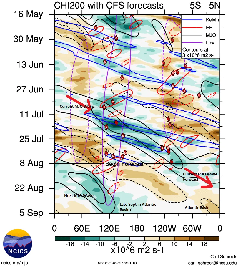
Over the last week, there has been an increase in tropical convection across the Atlantic basin with the National Hurricane Center watching several areas of convection coming of the West coast of Africa. These bursts of convection have been associated with African Easterly Waves (AEWs), which are waves in the atmosphere that move from east to west over the Sahel region of Africa. When combined with the expected enhancement of convection that was expected after the end of July associated with the next positive phase of the Madden Julian Oscillation (MJO) there is an even greater chance of tropical convection turning into named storm activity. In fact, the current MJO pulse that has traveled the globe has been enhancing named storm activity in the West Pacific and East Pacific over the last 30 days. The big question remains: will it lead to any new storm formation in the Atlantic Basin.
In the spirit of the closing of the 2021 Summer Olympic games this past weekend let’s talk about the hurdles that could limit a named storm from forming from the two systems that the NHC is watching. Currently, NHC has Invest 94L with a probability of development at 70% between now and day 5 and Invest 93L with a 20% chance of development over the next two days and 10% over the next 5 days. One of the major hurdles impacting both of these systems is dry air. The very busy map below shows Invest 94L moisture and wind shear through the middle of the atmosphere, which indicates that dry air will be present to the West, South, and North of the system’s circulation. This means that dry air could attempt to intrude into the system as it moves west into the Caribbean.

Land interaction from the various islands to the West over the next couple of days is another hurdle that can limit development. Lastly, if Invest 94L makes it over Puerto Rico and Hispaniola the other hurdle is wind shear from a large upper-level low near Florida that will be part of a cold front impacting the eastern part of the U.S. later this week. Wind shear is often a negative for weaker tropical waves as they move West.
Invest 94L has the most model support, but most of these hurdles should overall limit any significant strength of the system as Invest 94L tracks on a very similar path to Elsa did earlier this season, which, as suggested at the time, was a good indicator of what to possibly expect later in the hurricane season.
Regardless of whatever happens in the Caribbean over the next few days, some sort of convection should be near Florida or the Bahamas by the later part of this week. The ECMWF ensembles, which offer up 51 different forecasts, show confidence in a fully-developed tropical cyclone is low. There is likely a higher chance of a named storm in the Caribbean than near Florida later this week due to all the hurdles as discussed above. Only 11 of 51 ECMWF ensemble members depict a closed cyclone five days from now and only 1 of 51 members depicts a tropical cyclone of any intensity as a hurricane or strong tropical storm. At this point, the system will face plenty of hurdles.

However, the water is warm enough to support named storm activity in the Caribbean and is very warm around Florida. As Elsa showed earlier this year, tropical systems only need a short window to strengthen, but can just as fast weaken. At this time there is less thunderstorm activity associated with 93L and the forecast model do not support much development of this tropical wave. However, 93L is behind 94L and sometimes the second system can have a better shot at development as the lead system “clears the air” of dust and dryness. At this time it does not seem to be a concern as both systems should only bring manageable gusty showers and thunderstorms likely in the Lesser Antilles and parts of Florida and Bahamas later this week into the weekend. Invest 94L could become Fred, but it should stay a weak tropical storm based on current forecast guidance, but more likely just a tropical depression or open tropical wave over the next 5 days.
There is nothing else to watch for now, but chances are we will have plenty more disturbances to keep an eye on as we get deeper into August. As mentioned above, given our quiet stretch even the years 1999 and 2009 had plenty of activity after August 10th. Remember Hurricane Floyd in 1999 that gave Florida a good scare and impacted parts of the Northeast? Given the newest seasonal forecasts that were released last week by various forecast agencies, there is still plenty of activity yet to come. This offers up a great reminder: now is a great time to get our hurricane preparedness together and review your plan. This will make it much less stressful when it comes time to react.


