Catastrophic Event Is Unfolding
All eyes in the insurance industry are on Tropical Storm Helene, and for good reason. Helene could be upgraded to a hurricane at any moment and may strengthen into a major hurricane before making landfall in Florida's Big Bend region. Model track and intensity guidance have remained largely consistent, thanks to improved observations of Helene's current condition, which are now feeding into the weather models. This tropical update will begin addressing the potential impacts Helene may have upon landfall, which is forecasted for tomorrow, Thursday evening local time. With very strong winds right at the coast, it is a possibility that Helene will have a very fast forward speed upon landfall, which will bring strong wind inland into Georgia. After landfall, tornadoes will occur on the east side of the storm from Georgia up into North Carolina. As a PRE event sets up, historic flooding will occur inland in parts of Western North Carolina. The shape of the Big Bend will cause a record storm surge at the coast, but its fast forward motion will enhance the storm surge speed into the coastline and tamper its impact versus if it was a slower-moving hurricane.
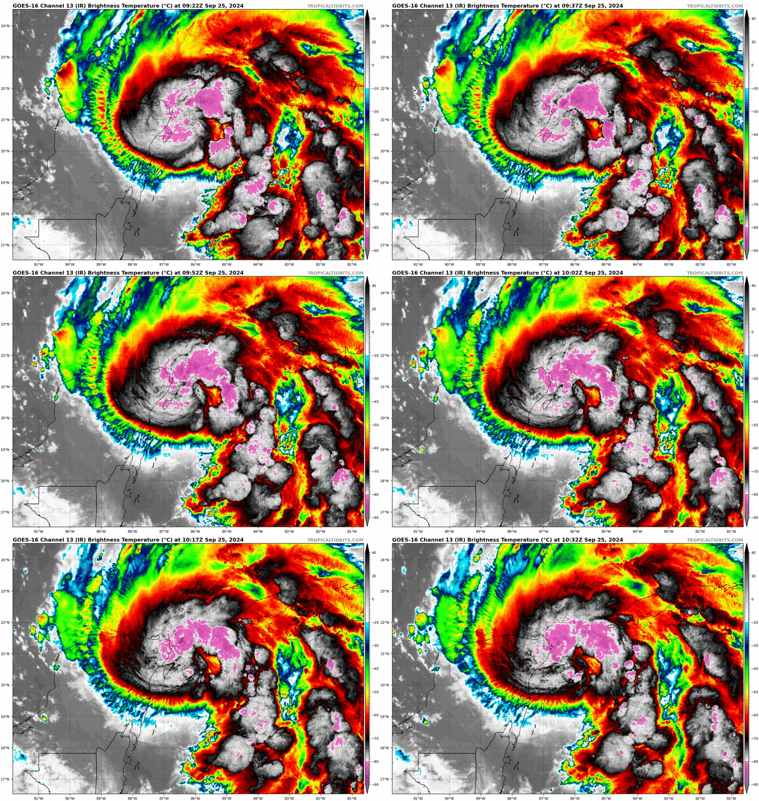
Helene is on the cusp of hurricane strength as it turns north into the Gulf of Mexico over very warm water with high ocean heat content, which has been discussed now over the last couple of BMS Tropical Updates. This morning's satellite image shows what meteorologists refer to as the "shrimp tail" appearance, a common sign of a strengthening storm. Helene is expected to stay off the Yucatan Peninsula, an area that had previously been a source of forecast uncertainty. With reduced land interaction, the storm is likely to intensify more rapidly as it approaches landfall.
Helene Landfall Impacts
The insurance industry should avoid relying solely on the National Hurricane Center to assess a storm's impacts, and Helene will serve as a prime example of why this approach is inadequate. The cone of uncertainty represents the potential track error, indicating that two-thirds of the time, the storm's center will fall within that cone. However, it provides the insurance industry with no insight into the storm's actual impacts, which, in Helene's case, will extend far beyond the cone of uncertainty. The most significant effects are on the right side of the storm track and the landfall location. At this time, it appears to be between Panama City Beach and Cedar Key, with the general consensus of the landfall location near St. Mark, FL, in the Big Bend region of Florida. For the overnight model guidance, here is a look at the four hurricane-specific model landfall locations and intensity.
HAFS-A: 140 kt/928 mb Cat 5 Southwest of Perry, FL
HAFS-B: 150 kt/920 mb Cat 5 Southwest of Perry, FL
HWRF: 125 kt/931 mb Cat 4 Southwest of Perry, FL
HMON: 115 kt/946 mb Cat 4 St. Marks, FL
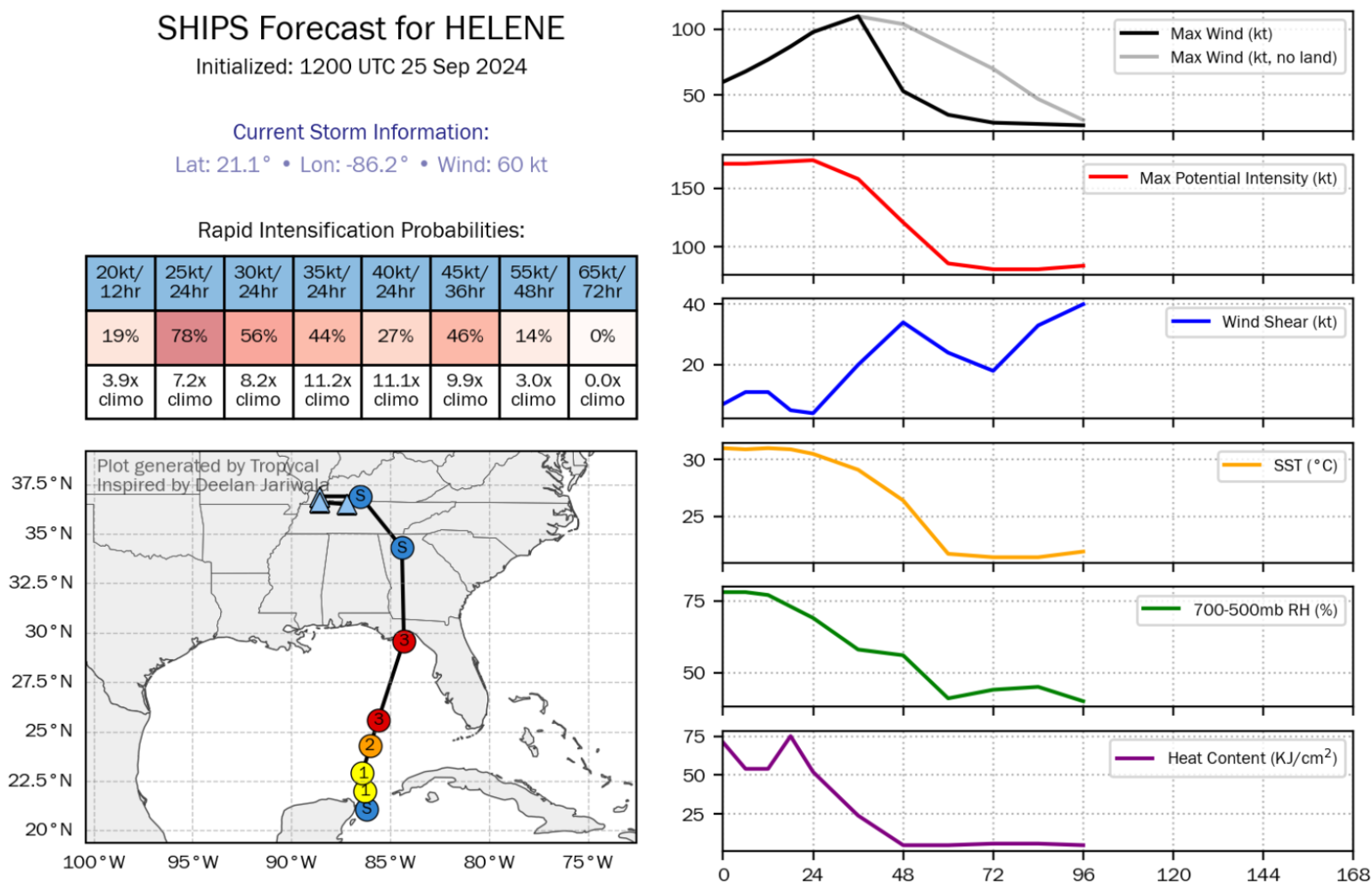
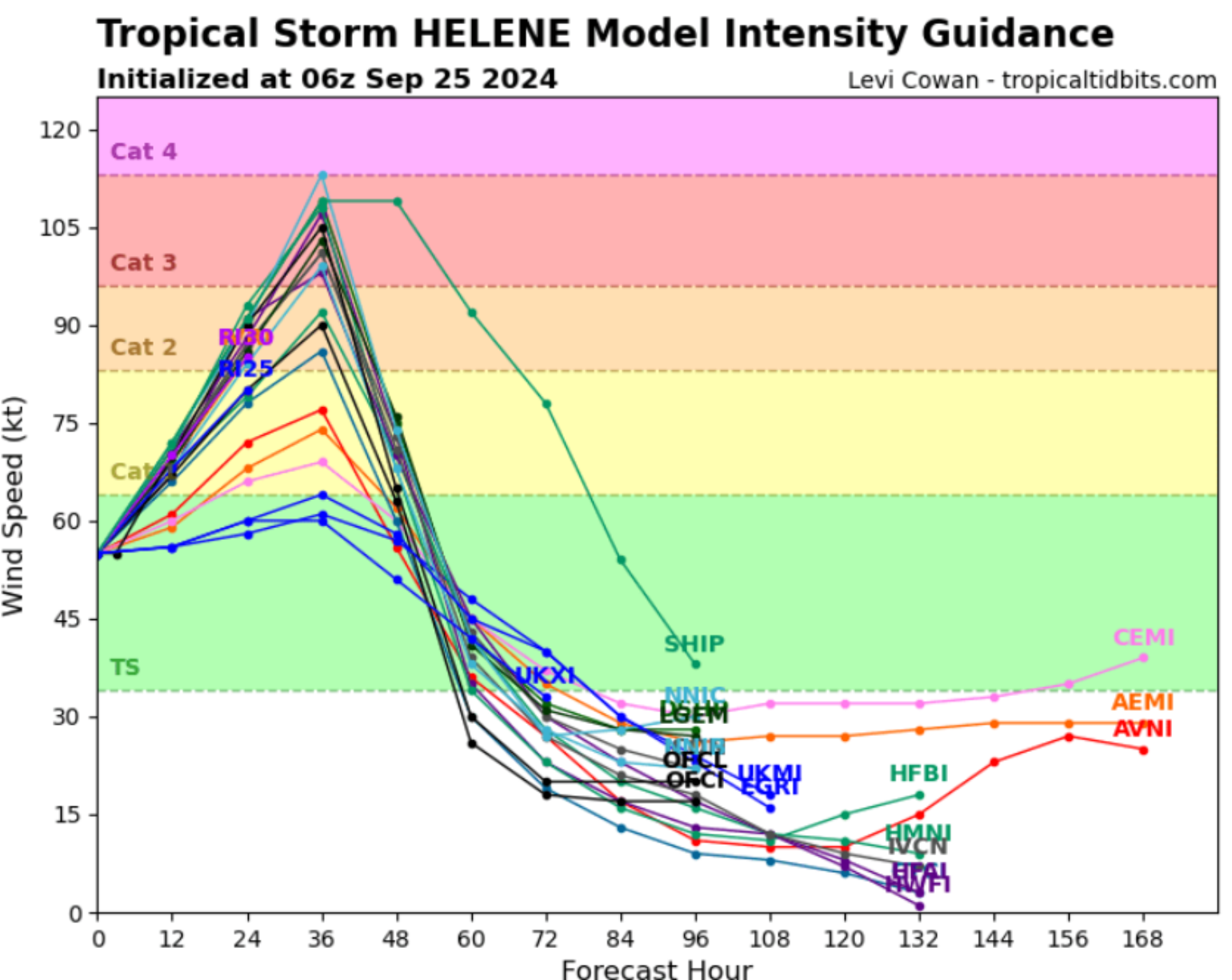
The latest intensity guidance by the National Hurricane Center could be viewed as conservative, so there is clearly room for adjustment upward. They are currently forecasting a Category 3 hurricane upon landfall.
Rural Landfall Area
A large Category 3 storm making landfall would ordinarily cause two to three times that amount of impact. While it is unfortunate for those in the storm's path, the bigger picture offers some relief as the worst of the storm is expected to impact a sparsely populated section of the coast.
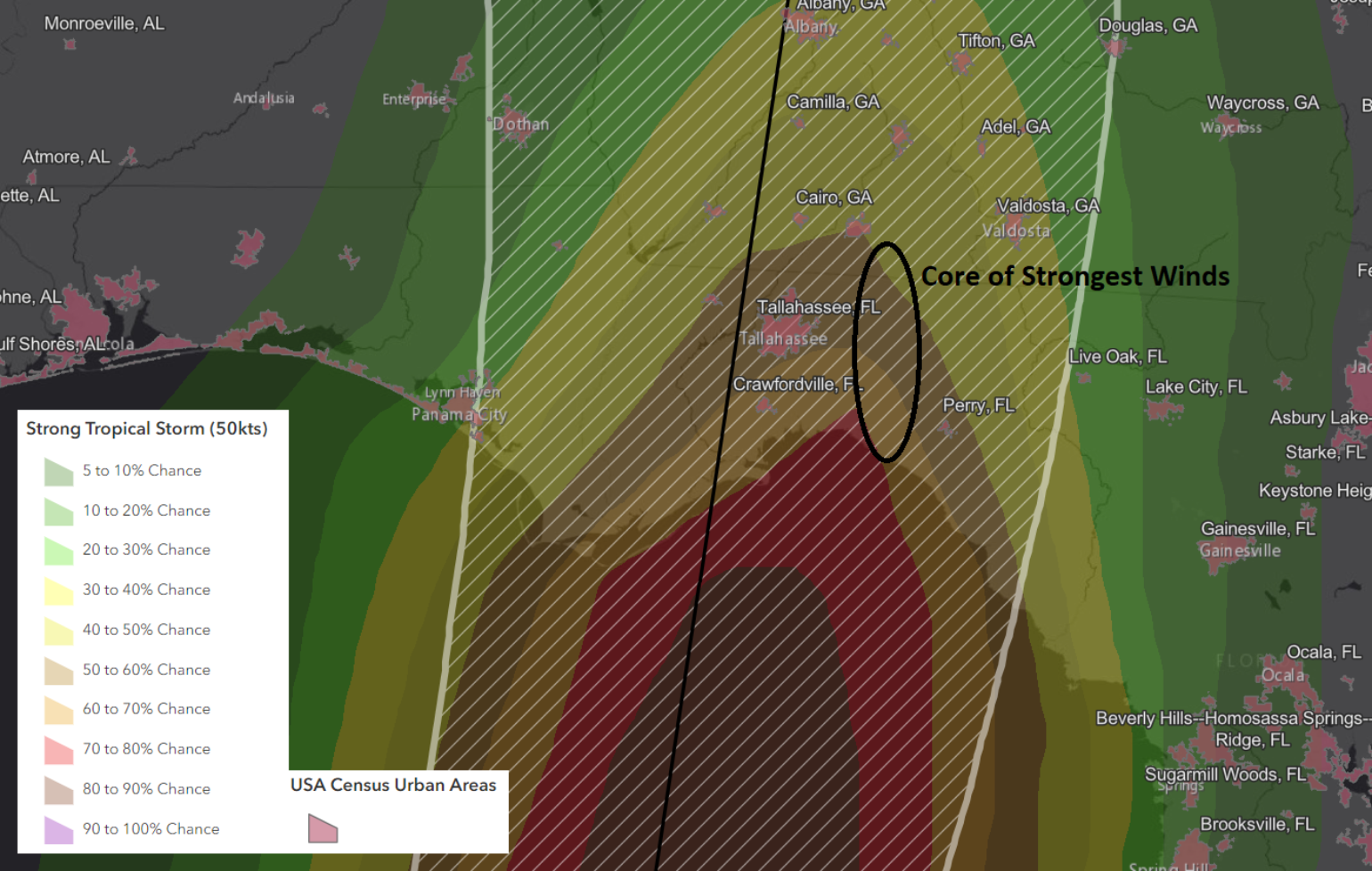
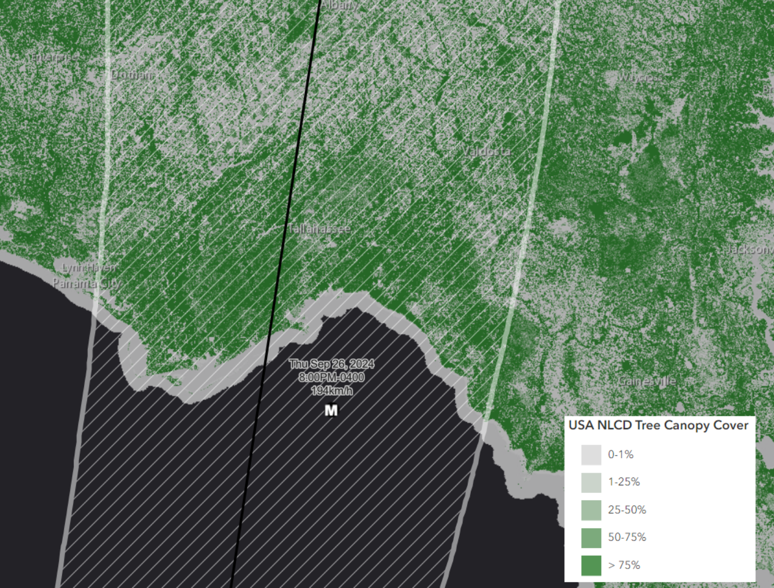
Still, on this track, the Tallahassee area looks like it could be on the weaker side but will still see extensive impacts, primarily from treefall, which was a big issue with Hurricane Hermine 2016. Also, the area is still recovering from the May 10th tornado outbreak that caused damage across the metro areas, with many ongoing repairs. As mentioned, impacts will go well beyond the landfall location, which again is relatively uninhabited. Still, in this case, due to the size and forward speed, Helene will cause widespread outages well inland. Due to the saturated soil in North Florida and Southern Georgia, tree fall could be higher than usual as well. North Georgia and Atlanta areas have actually been dry, so the ground is more stable, but that does not mean trees and limbs will not come down since this is likely the strongest named storm wind event for the region since Michael in 2018.
The Tampa/St. Pete's area looks to be sideswiped, but impacts will depend on wobbles in the storm's path. As seen on the main BMS iVision swath map below, Helene is forecast to have a large wind swath, but the worst of the winds will stay barely offshore. Still, significant power outages are possible across North Florida, and scattered outages, even on the east coast from the Orlando area up to Jacksonville, are possible with some of the expected outer band thunderstorm activity.
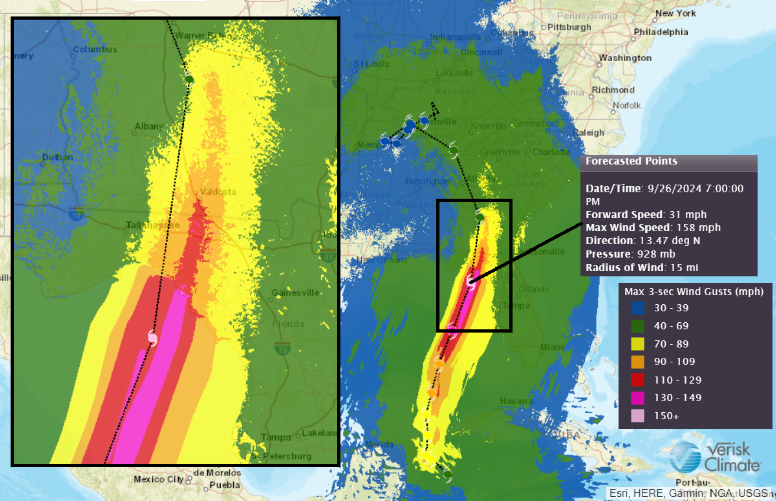
After landfall, impacts across South Georgia will be extensive as Helene's faster landfall speed, which looks like it could be moving at 30 mph, is very unusual for a hurricane. This will bring stronger winds further inland. With the GA/FL border less than 50 miles from the coast, most of central Georgia will see significant power outages, and the area around Albany to Tifton to Valdosta and south to the border will likely see the highest damage potential. Damage will lighten as you travel upwards into North Georgia, with the strongest winds still staying east of the Atlanta areas.
Other Types of Impacts
Fast-moving hurricanes often generate weak tornadoes, as the rapid forward motion increases wind shear with height. These tornados are often weaker, short-lived F0-F1 storms, so most well-built homes will be okay with some roof damage. Of course, the southeast has a lot of mobile homes along the damaged swath, especially in Albany-Tifton-Valdosta and south to the coast, which are expected to be the primary construction types that will be the most vulnerable.
Although storm surges are difficult to predict at this stage, as they depend on the storm's forward speed and overall size, the NHC offers an excellent tool for understanding coastal inundation. The most significant storm surge areas appear to be from Fish Creek, FL, to the west of Steinhatchee, FL. Given the size of the storm, a huge section of the coast will likely see high surges, but if Helene was slower-moving, storm surges could be much worse.
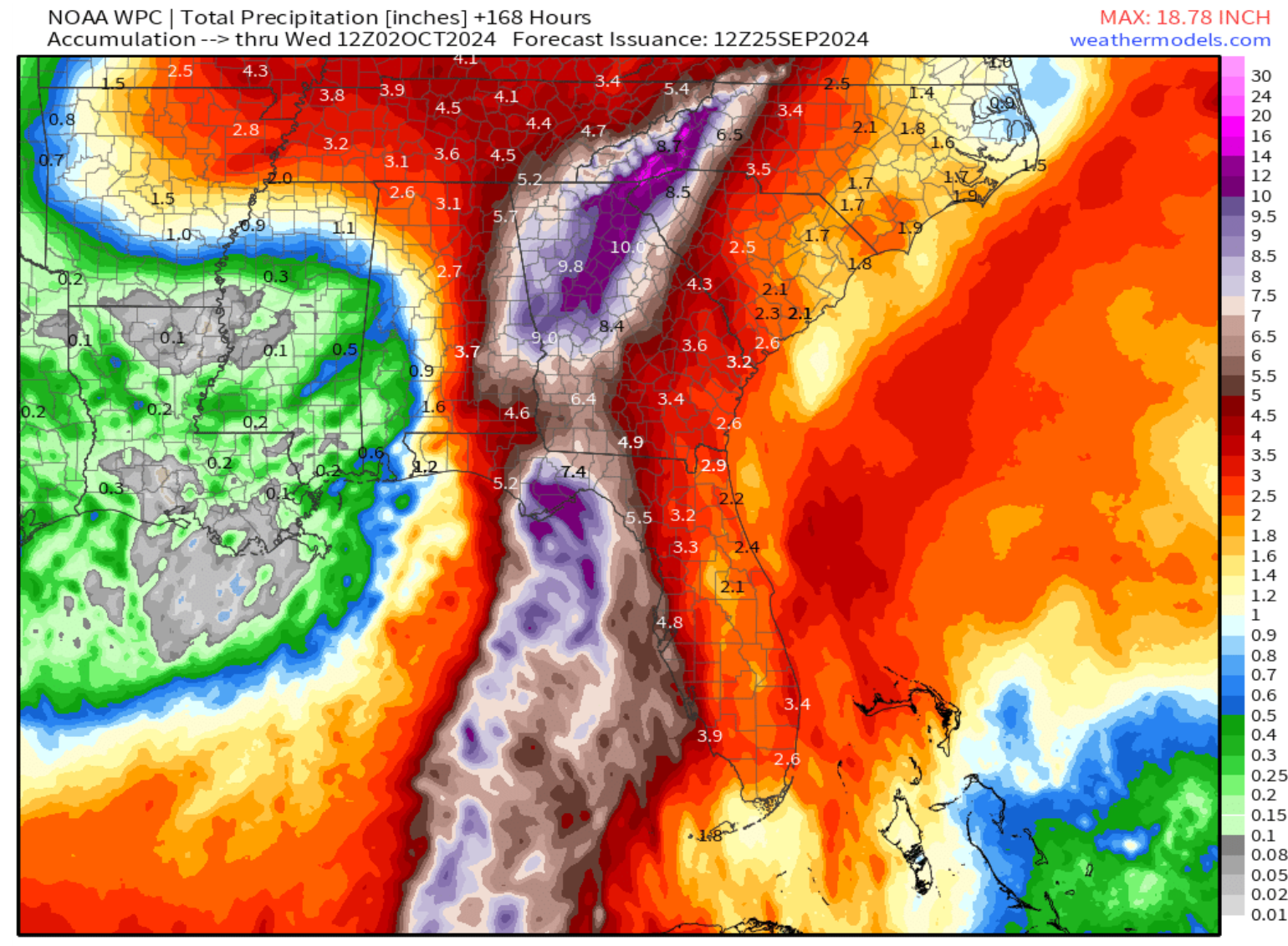
As a PRE event sets up, historical flooding is expected in North Georgia and Western North Carolina along the Appalachian Mountains. At this point, rainfall amounts of 15 inches cannot be ruled out, and when combined with more complex terrain, local streams and rivers will quickly flood.
Insurance Industry Loss Picture
It is still too early to provide loss estimates for the insurance industry, as a shift in the storm's path closer to Tallahassee could significantly raise the overall losses. There are still questions as to the overall size of the wind swath and how it might impact the west coast of Florida. In general, however, given the rural nature of much of the Florida landfall area and areas into southern Georgia, it should provide a lower loss than what was experienced in Hurricane Michael in 2018 ($16B), which had a track west of Helene as a category five hurricane with strong winds up into southern Georgia. We have to remember that Idalia made landfall in the same general area last year as a major hurricane, and according to the catastrophe risk model, this was one of the strongest hurricanes to make landfall to have such a low level of loss and that was partly due to the rural nature of the landfall areas. Helene will likely fall into the same category: powerful hurricane but with reasonably low insurance industry loss.
Helene has been in the named storm rotation since 1982. That is a long time, and throughout this course, it has shown up eight times in different seasons, six of which have been a hurricane, but have never retired. It is worth wondering if this will be the last time we see the name Helene on the storm list, as what appears to be a catastrophic event is unfolding for parts of the Big Bend Region. Ironically, until last year, this area had not seen a landfalling hurricane since 1852. With Idalia last year and Debby this year, it has clearly become a target for U.S. landfalls.
