Believe it or not, Hurricane Beryl has now been a named storm entity in the Atlantic basin for one full week. On Friday, June 28th, it became a tropical depression 1,225 miles east southeast of Barbados. Since then, Beryl has had limited damage to the insurance industry and has had grazing impacts on most Caribbean islands, except for the small islands such as Carriacou in the Windward Island, as it has traveled 3,125 miles to its landfall locally just north of Tulum, Mexico, near Puerto Aventuras, Mexico this morning. This also means Beryl has allowed this to be the most active start to the Atlantic Hurricane in terms of Accumulated Cyclone Energy surpassing the busy season of 1933.
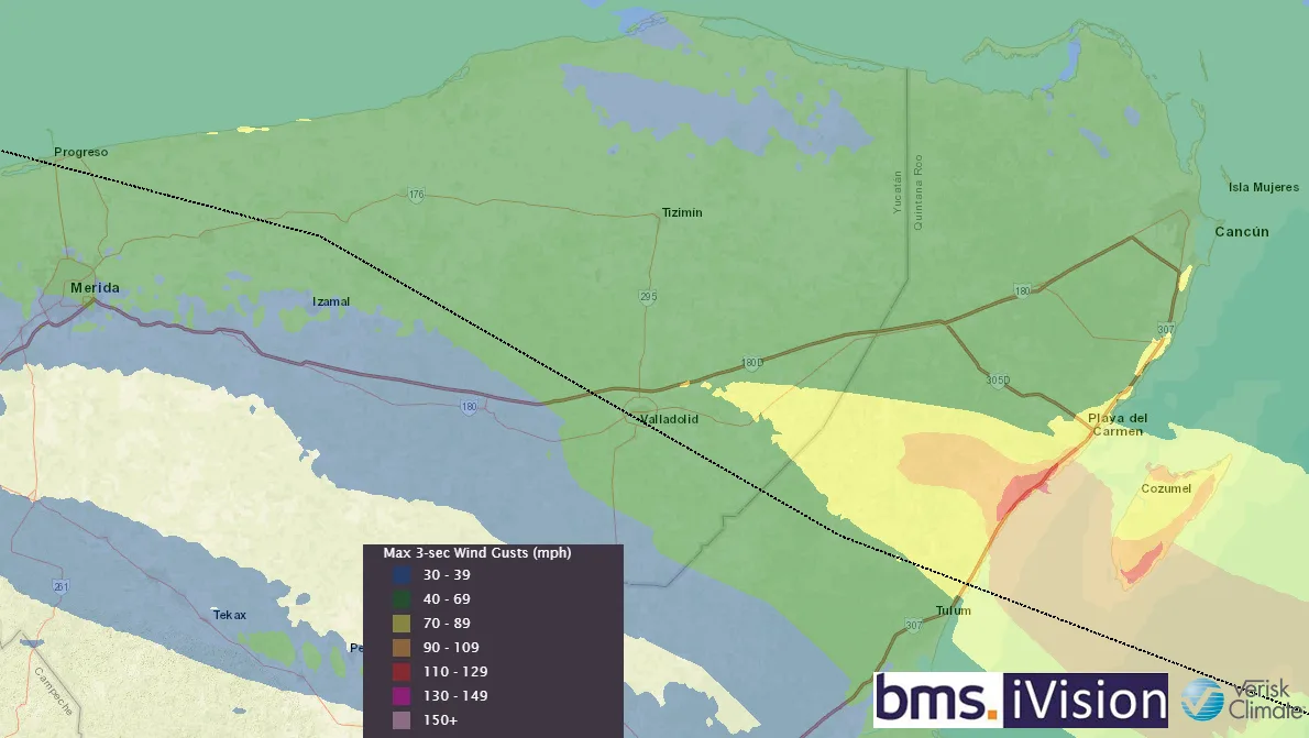
Beryl Landfall Mexico
Beryl made landfall as a modest Category 2 hurricane. The last Category 2+ hurricane to make landfall within 30 miles of this location was Hurricane Wilma and Emily in 2005, but Emily was much closer to the path that Beryl took and much stronger. Given the overall structure of Beryl, it is a bit disjointed at landfall, and the Category 2 (110 mph) wind rating at landfall might be generous based on what the radar and satellite trends looked like at landfall. Beryl’s structure was likely influenced by some southern wind shear and ingested some dryer air from land, allowing for a lopsided structure, which means the highest impacts would be to the north of the storm, which might be unfortunate because this is where the majority of the exposure is north of Tulum with the many different beach resorts, including the staff, to support them.

According to veteran storm chaser Josh Morgerman (iCyclone), who has chased 71 different named storms worldwide, he has seen trees down and powerlines with some spotty wind damage in Playa Del Carmen. He noted some collapsed facades on some buildings, but his general take on Beryl is that it is an unravelling mess. He was surprised at the landfall intensity, given what he experienced of similar categories in the past. Overall, it seems that the insurance industry's impact will be extremely low, but landfall has just occurred, so more observations are needed to make a full assessment. Clearly, the resort communities along Playa del Carmen are no strangers to hurricanes of this magnitude and should be fairly resilient to major building damage.
Beryl’s End Game
Beryl is not done yet. If you have been observing Beryl's track and intensity forecasts over the last week, you will have noticed the National Hurricane Center (NHC) track forecasts have been extremely good, far below their 5-year average error. The intensity forecasts have been biased low; and errors have been above their 5-year average. This is concerning for two reasons.
Beryl NHC tracks keep shifting northward towards the Texas coastline with an expected landfall near or north of Brownsville, TX now.
The intensity forecast has been consistently low, and there is a very good chance this trend will continue with a chance of a major hurricane at landfall as the current NHC intensity forecast has a Category 1 hurricane, which would be manageable for the insurance industry.
Given its faster forward motion, it does not appear that the Yucatan Peninsula will phase Beryl much, so it should have a well-defined structure as it enters the warm waters of the southern Gulf of Mexico.
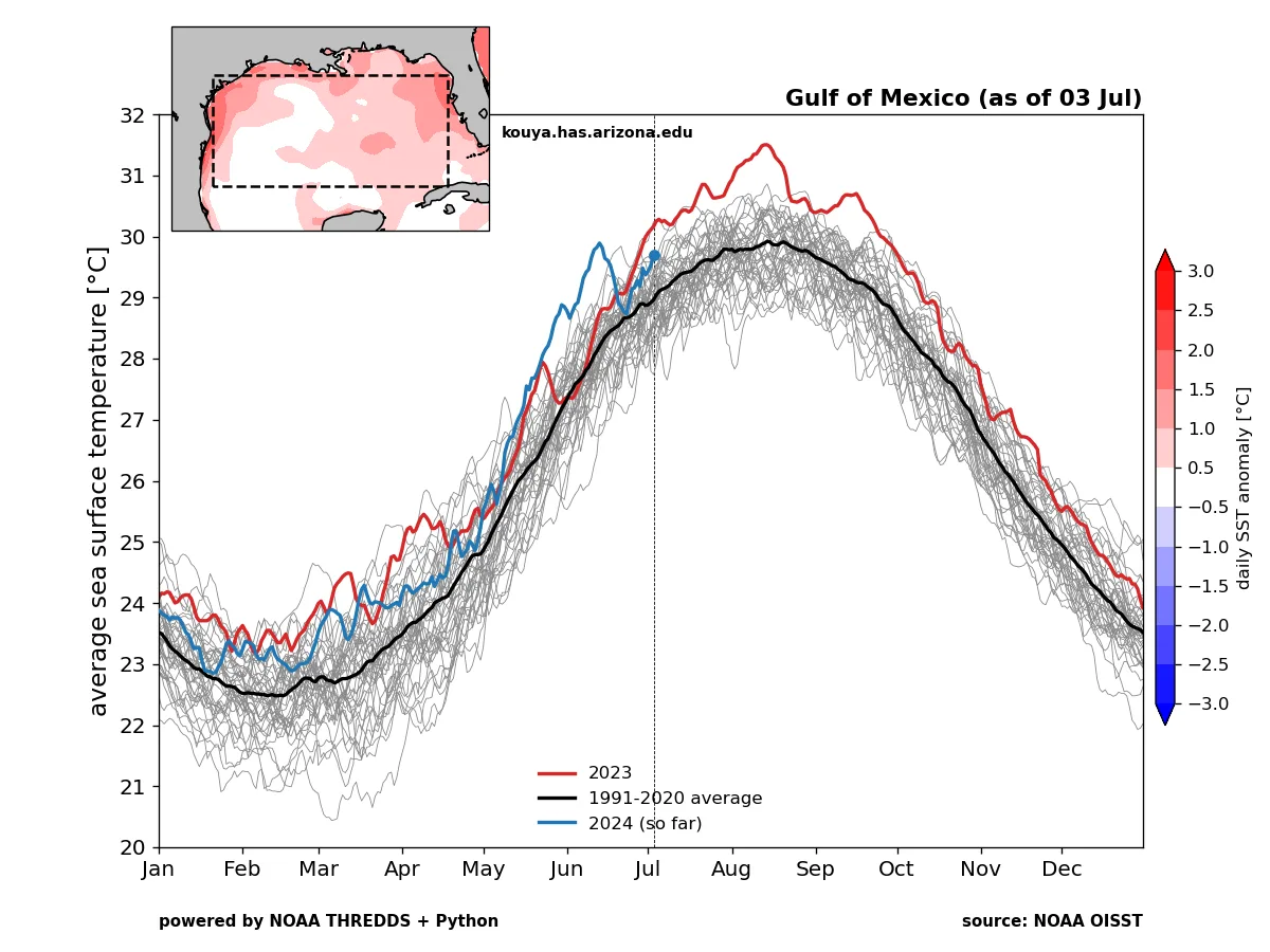
Along with the warmer sea surface temperatures, Beryl will be moving into a favorable environment for development with the core intact as a small circulation. Many hurricane models suggest a rapid intensification up to a major hurricane. Perhaps you have been trying to enjoy the July 4th weather in the upper Midwest. In this case, you know it has been miserable and cold, which means the trough of low-pressure means business. Further, this means it is likely an opportunity for Beryl to have favorable trough interaction as it nears the Texas coastline Sunday and gets pulled further north near Corpus Christi as a stronger storm as Beryl will have just that much more time over open water to intensify.

Insurance losses cannot be impacted at this time, but it is safe to say there will be impacts on the U.S. insurance industry. Along with the typical wind and storm surge damage highlighted with Alberto back in the middle of June, Beryl will have a footprint of heavy rainfall well inland along the east of its track early next week. This is a concern because the ground is quite moist from the spring rain events that impacted east Texas and western Louisiana earlier in May and June. It should be noted that Louisiana insurance industry impacts will be limited at this time, and this should be a Texas-only impact. Tomorrow there will be a much better idea on the severity of Beryl impacts to the Texas insurance industry.
Beyond Beryl
The latest ECMWF seasonal climate model guidance was released yesterday. It shows that the overall seasonal activity has been dialed back from 100% in June to now just 40% above average. The June forecast from the climate model had 11.3 hurricanes forming over the season, and now it is down to 8.4, with the average in a given season being 7.2. This is excellent news for the insurance industry, and yes, we have had a very active start due to one storm. So far, it appears that most of July will be quiet according to the ECMWF 45-day forecast, with just some subtle hints of activity into the start of August.