

Are you Kidding Me?
The insurance industry is likely sick to its stomach knowing that it has to deal with a named storm impact in November, let alone in the state of Florida. Climatology points to just how rare this is for the insurance industry. Only five named storms since 1851 have made landfall in the U.S. after November 5th, all on the Florida Gulf Coast. Only one of those was a hurricane at the time of landfall. The latest U.S. hurricane landfall on record was Hurricane Kate in 1985 on November 21.
However, getting a hurricane to make landfall along the East Coast of the U.S. is extremely rare in the month of November, but still possible. In fact, on November 4th, 1935, a hurricane dubbed the Yankee hurricane, took an unusual track from the northern latitudes and impacted the Bahamas and South Florida as a Category 2. Today, this late-season hurricane impact would cost the insurance industry $3.5B.
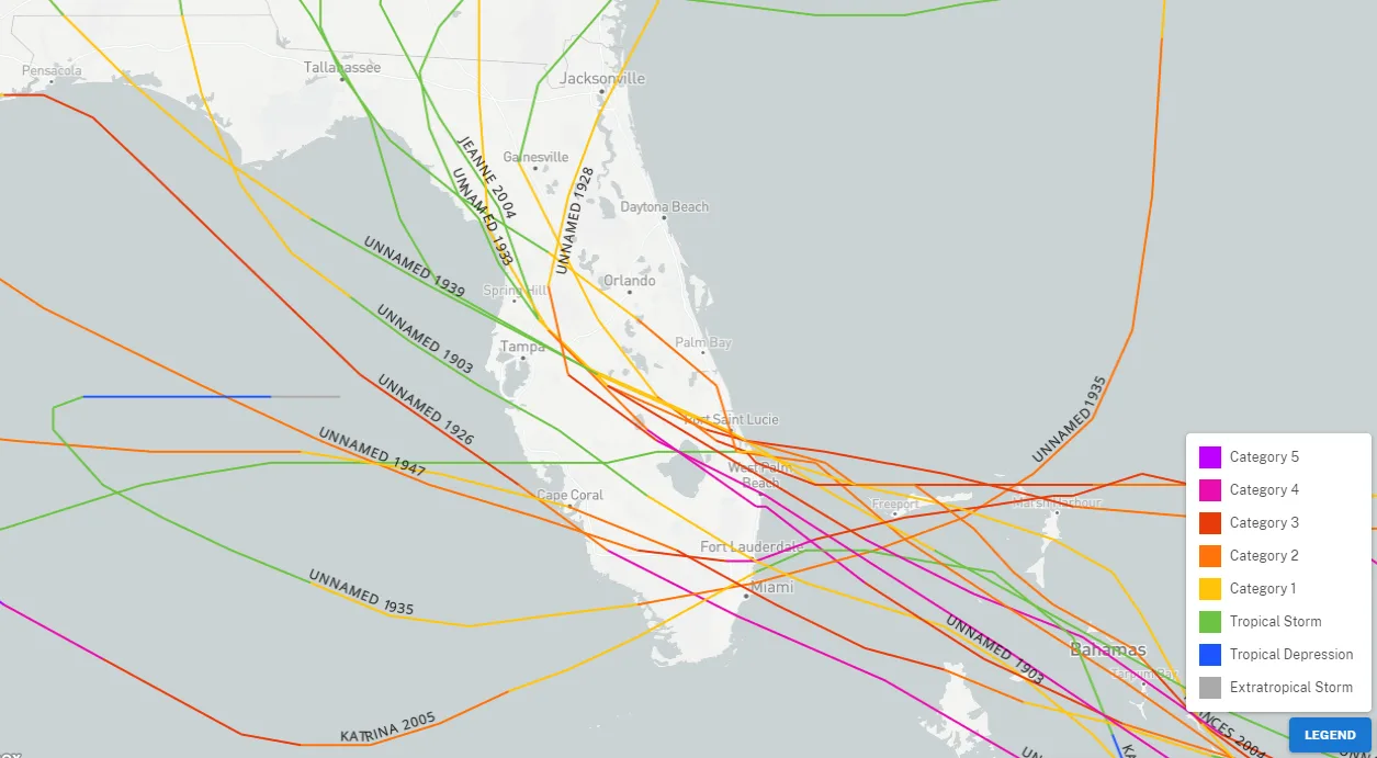
Interestingly, when we look at the hurricane history of landfalls between Miami and Port Saint Lucie, FL, it has been 17 years since this section of the coastline has had an impactful hurricane come in from the East. That hurricane was Katrina’s first U.S. landfall in 2005. This is pretty amazing, considering the changes along the coastline since 2005. Of course, the year before, Jeanne and Frances came in from the east as well. Since 1851, it seems only 15 hurricanes have taken similar tracks along this section of the coastline, so overall, one might even say it is fairly rare to get a hurricane making landfall from the east regardless of the month.
Nicole Forecast Intensity
One of the biggest questions with Nicole is how much impact will occur on the insurance industry, which is directly related to how strong it will become before making landfall. Nicole is currently in a subtropical storm. What does that mean? A subtropical storm typically has a large, cloud-free center of circulation, with very heavy thunderstorm activity in a band removed at least 100 miles from the center. While winds can be the same, the difference between a subtropical storm and a tropical storm is that tropical storms generate more rain. There is no such thing as a subtropical hurricane. If a subtropical storm intensifies enough to have hurricane-force winds, it must have become fully tropical. The definition of a subtropical storm, according to the National Hurricane Center: Is a non-frontal low-pressure system that has characteristics of both tropical and extratropical cyclones. This morning the satellite imagery shows Nicole’s core is more compacted, and intensification and transition to a tropical storm is likely today.
Some models expect Nicole to be a low-end Category 1 hurricane as it approaches the Florida East coast, and the NHC forecast is also suggesting this with a 75 mph 1-minute wind speed at landfall. Although the maximum intensity of Nicole is a bit uncertain because Nicole already has a broad area of circulation, the broad wind field is vast, with bands of convection extending over 500 miles from the center. Larger named storms take longer and have a more challenging time spinning faster. Think of a figure skater. If the arms are out, they spin slower; if the arms are in, they will spin faster. Since Nicole's arms represent the size and are currently out, it will take longer for her to spin faster. These broad wind field mean the area of onshore winds will also be larger, so Nicole has a higher integrated kinetic energy which results in more energy for storm surge. What could happen with a large circulation is that an inner core of convection could develop before landfall as the subtropical characters become more tropical. This would give Nicole a higher intensity over a small area and a wide area of tropical-storm-force winds.
A few things are going against this possible scenario. One is dry air, the other is wind shear, and possibly a third is Nicole’s structure should be asymmetric. The only factor that seems to be positive is the sea surface temperatures, which are about 82 degrees Fahrenheit or about 1.5 degrees above the normal, so nothing too impressive. However, the trend will be an intensification toward landfall. Therefore, a rapidly deepening 12 hours before landfall should be expected, given the track over the warm gulf stream waters. In this case, do not be surprised to see a bit stronger storm than what is forecasted by most of the model guidance, which suggests a strong tropical storm or weak hurricane.

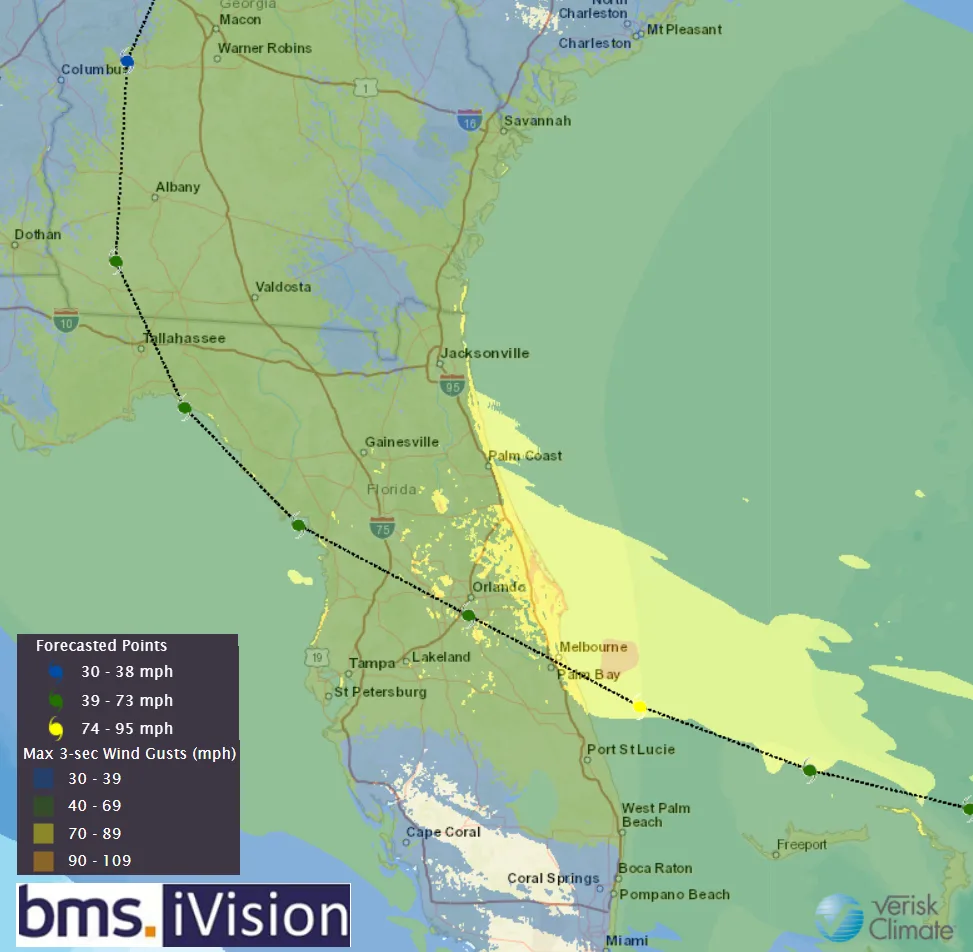
The image below of BMS iVision shows that the radius of maximum winds is about 35 miles before landfall. The extent of hurricane wind gusts will extend to the north (right side of the track) 80 miles. Overall, it is expected Nicole to be asymmetric in her approach to Florida. With a track like this, one could have rain and tropical-storm-force winds from Port St. Lucie to Jacksonville, but much of Miami and West Palm Beach would not even get much rain or wind. As a result, the overall track landfall location will be important as to what areas do not experience much impact to the south of the track, and the general trend has been to the north. So Melbourne to Dayton Beach landfall location appears to be part of the trend.
With winds of 40 mph already extending a whopping 380 miles northwest of Nicole’s center, tropical-storm-force gusts are likely along the coast by late Tuesday from Savannah to South Florida, with gusts increasing to 50 mph or greater in this swath on Wednesday as Nicole approaches. If a convective core develops, a much smaller area of coastal hurricane-force wind gusts may slot in somewhere between Cape Canaveral and Melbourne overnight Wednesday into Thursday.
Nicole Storm Surge Impacts
Even with the uncertainty in the intensity forecast, Nicole’s overall size and a tight pressure gradient with a strong high pressure to the north are still responsible for its eastward track movement toward Florida. A large area of strong onshore winds will result in several days of beach erosion and coastal flooding, which will only get worse as Nicole tracks toward the coastline. There is a high chance that Nicole provides an area from Charleston, SC, to Port St. Lucie with 1-4 feet of storm surge. The other things to consider with the storm surge are the king tides caused by Tuesday’s full moon and the lunar eclipse. We have seen that with past storms like bypassing Matthew in 2016, beach erosion and storm surge damage can add up.
Nicole Rainfall Impacts
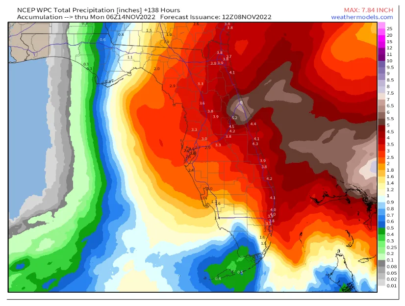
General rainfall totals of 2-5” are likely over much of the peninsula through Friday. The heaviest rain will bring flash flooding potential to South Florida and East Central Florida, where Ian’s precipitation impacts are lingering.
Insurance loss Implication
While details may change, overall storm surge, wind, and rain impacts are high, given Nicole’s forecast for East Central Florida. This is not an Ian-like situation, but the coastal flooding, in particular, will be nasty along Florida’s East Coast, which has not seen a direct hurricane landfall since 2005. One thing is certain when the wind blows in Florida, claims will result, and with the expected large wind field of tropical storm force winds, these claims could result over a large area. Let us take the example of Ian. Below is a plot of Ian’s maximum wind gust in MPH and the plot of the top 20 counties with claims reported to Florida OIR as of November 2nd. Notice a large number of claims far away from the landfall location. Especially in the counties of Orange (28K claims), Seminole (10.2K claims), and Volusia (32K claims), which experienced fairly low wind gusts of 60 – 70 mph. Note the claim in Palm Beach, Broward, and Miami-Dade that maybe experience 30 to 40 mph wind gusts.

One might say Orange, Seminole, and Volusia counties had wind and lots of rain. Nicole will also produce similar low wind speeds and a good amount of wind-driven rain; it could be expected that claims can quickly add up in Florida over areas that might not experience the severe condition. This will be a manageable cat event, and an event that might hurt more for carriers as event loss might end up falling below carriers’ catastrophe reinsurance programs, mainly since these retentions have been pushed up over the last several years. The impacts will be broad, like Hurricane Matthew, which recently tracked up the entire east coast of Florida with tropical-storm-force winds and coastal erosion. However, Matthew still caused about $1B dollars of insurance industry loss without making landfall. Hence, a one or two-billion-dollar loss is not out of the question here if Nicole makes landfall as a Category 1 hurricane and the windfield stays as large.


