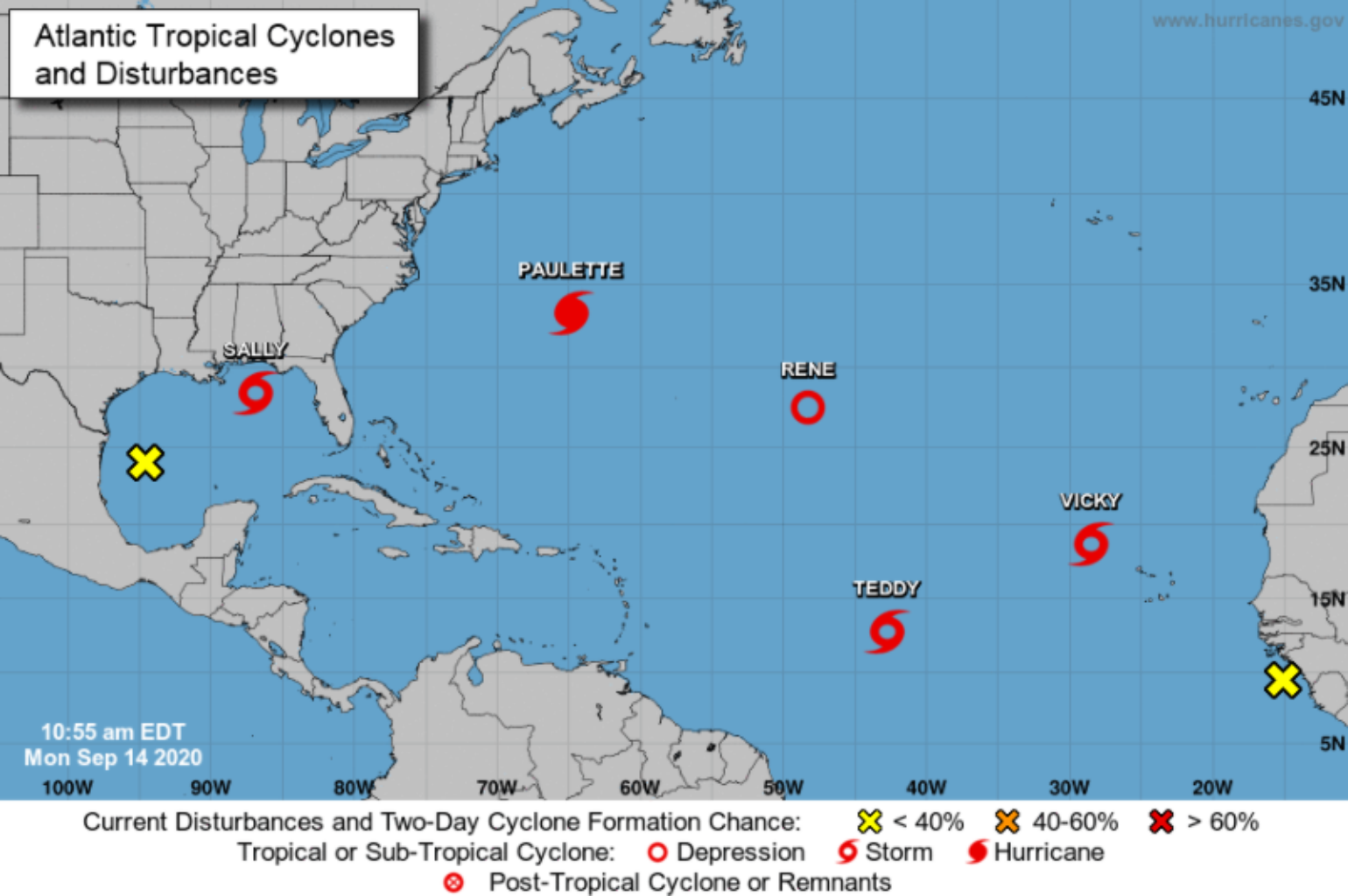
The National Hurricane Center (NHC) is currently tracking eight tropical systems across the East Pacific and the Atlantic Ocean. Six of these require issuing advisories at specific times, so the NHC forecasters are busy. This amount of activity is a clear example of why the climatology points to September 10th as the peak of the Atlantic hurricane season. In fact, last night the NHC upgraded one of these tropical systems to tropical storm Teddy and another this morning to Vicky, in the central tropical Atlantic. This means there is now only one name left in the hurricane alphabet (Wilfred) before the NHC will start using the Greek alphabet. This year has been an astonishing one by many accounts and we are still at the peak of the season. Of the five named storms that are currently active in the Atlantic Ocean, which ties the record for the most named storms in the basin at one time (the other time being September 11-14th in 1971), only two storms are a threat to the insurance industry - Paulette and Sally.
Paulette Impacts
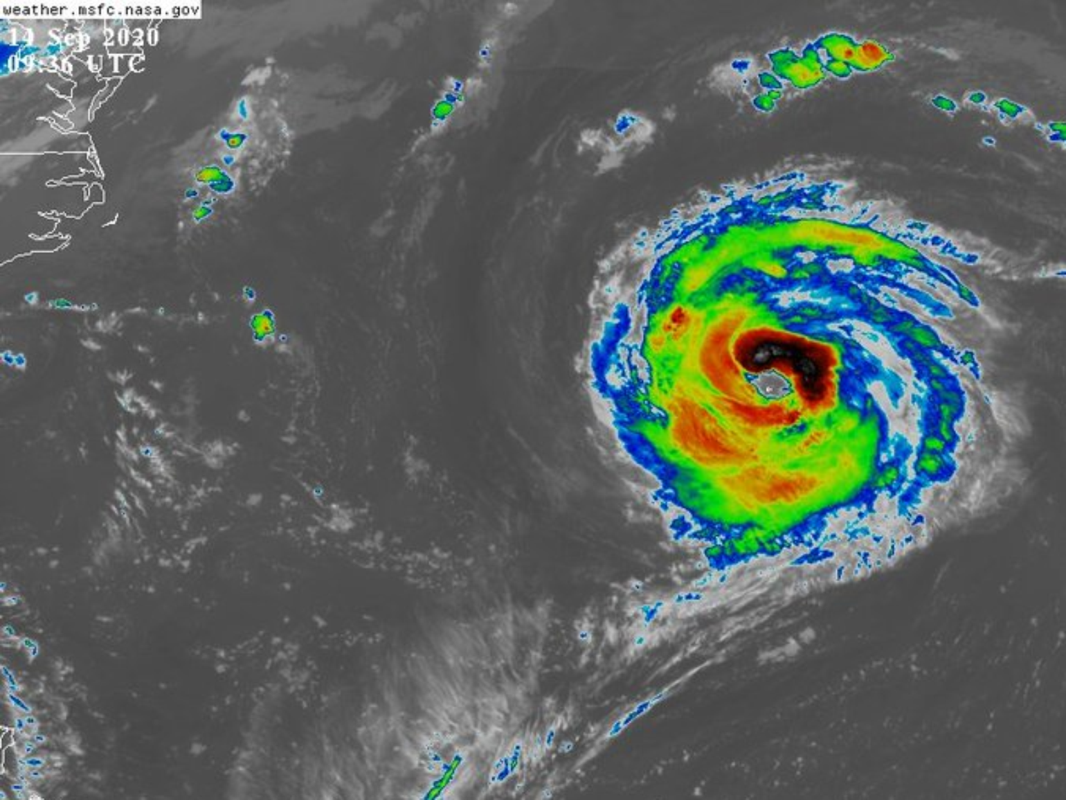
The nearest landmass to Bermuda is over 600 miles away, and its islands make up only about 22 square miles of area. Early this morning the small island was completely in the eye of Paulette, which has incredibly slim odds of happening given the overall size of the tropical Atlantic basin. However, if you have ever been to Bermuda, the island not only has several historical forts, but the entire island is built like a fortress because it seems to be a hurricane magnet. Over the last several years the island has had several hurricane impacts, including just last year with major Hurricane Humberto’s southern eye impacting the island. The economic damage was estimated at 25 million dollars. It appears Paulette might not be as destructive, even though the entire island got to experience the eye of the storm. However, it is early and the Bermuda Weather Service reported a gust of 117 mph at a site 290 ft. above sea level at the Marine Operation Center. Bermuda experiencing the eye might have been a good thing versus Paulette tracking to the west 20 – 30 miles, since it would have put the island on the stronger side of the storm on the eastern eyewall. Overall Fabian of 2003 still seems to be the recent benchmark storm for the island.
Sally Update
The most notable change with the overnight forecasts is a shift east in the storm's expected track. This is a much better outcome for the insurance industry than what the forecast called for yesterday. The threat to New Orleans is no longer quite as high as it was yesterday, but coastal cities to the east could see more of an impact. Sally is now a solid Category 1 hurricane and expected to be a weak Category 2 hurricane before landfall. Sally is undergoing rapid intensification this morning so a stronger category 2 hurricane at landfall can’t be ruled out. Weaker developing storms like Sally are harder forecasts for the models and what makes Sally even more complex is that it is approaching somewhat parallel to the coastline. Sally’s model landfall spread spans from south of New Orleans to the Mississippi-Alabama border, and there is still a bit of unknown regarding when Sally will turn north. The trend over the last 12 hours has been to the East, which is much better news for not only the areas impacted by Laura but for the major population center of New Orleans. This is good news for the insurance industry and the New Orleans area who are now very unlikely to see the worst of Sally’s rain, wind, or surge. Gusts of 40-50 mph will still cause local power outage issues, and surge off Lake Pontchartrain (4-6+ feet) will still cause flooding. But, given the potential Sally had to push hurricane winds through downtown New Orleans and much higher storm surge, this is very welcome news.
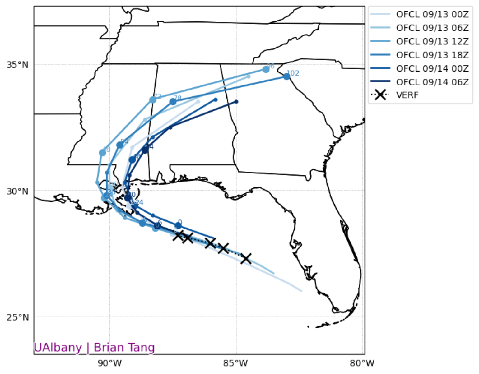
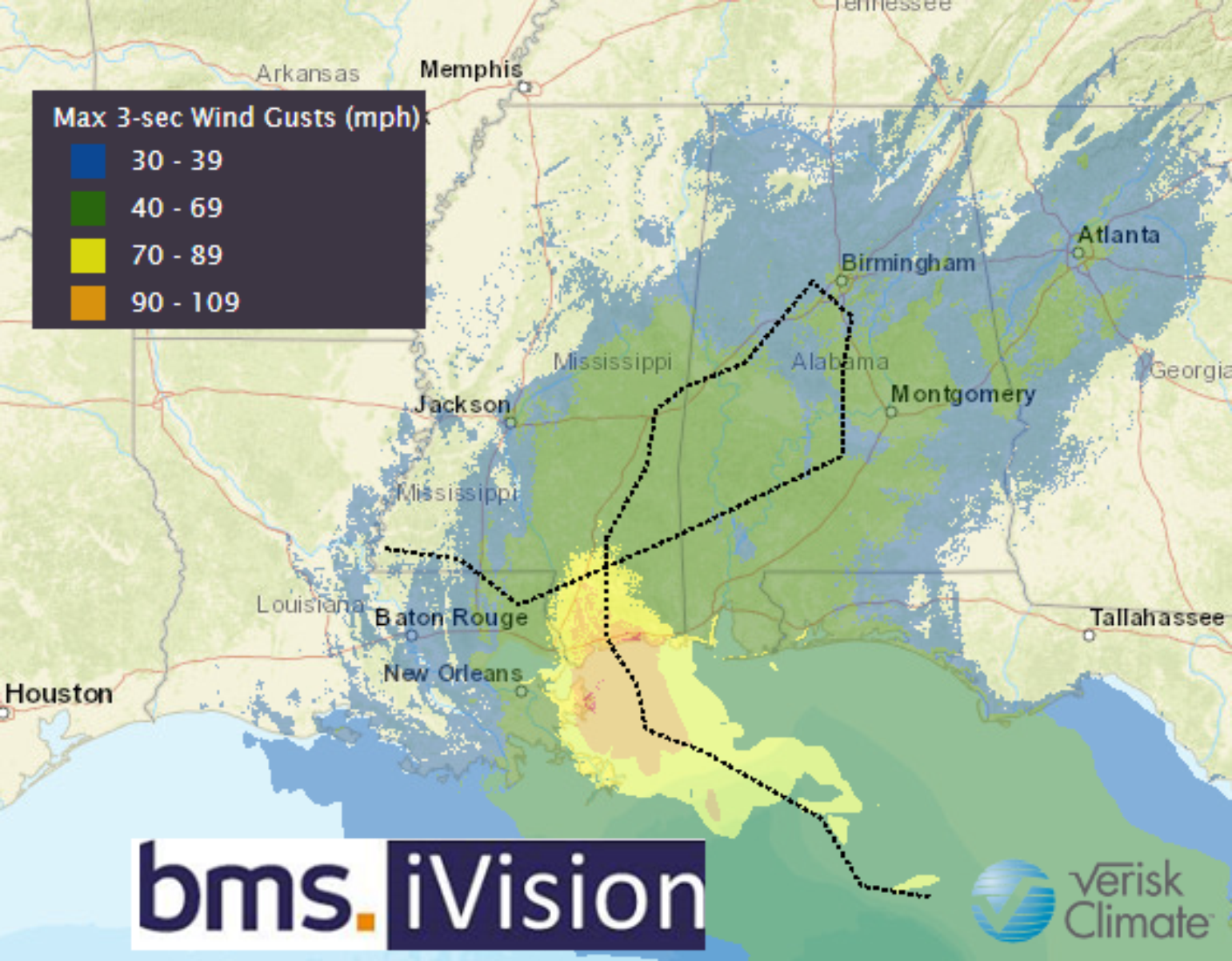
When it comes to shifting tracks for landfalling hurricanes, the good news for one area is bad news for another. The bad news is for southern Mississippi, southern Alabama, and far western Florida which will now be closer to the center of Sally as it moves onshore. One of the other big changes in the last 24 hours is the expected rainfall, which now looks like there could be isolated totals past 20″ as the system slowly crawls onshore. This rainfall will be east of New Orleans so it will not be as much of a strain on the pump system as previously thought.
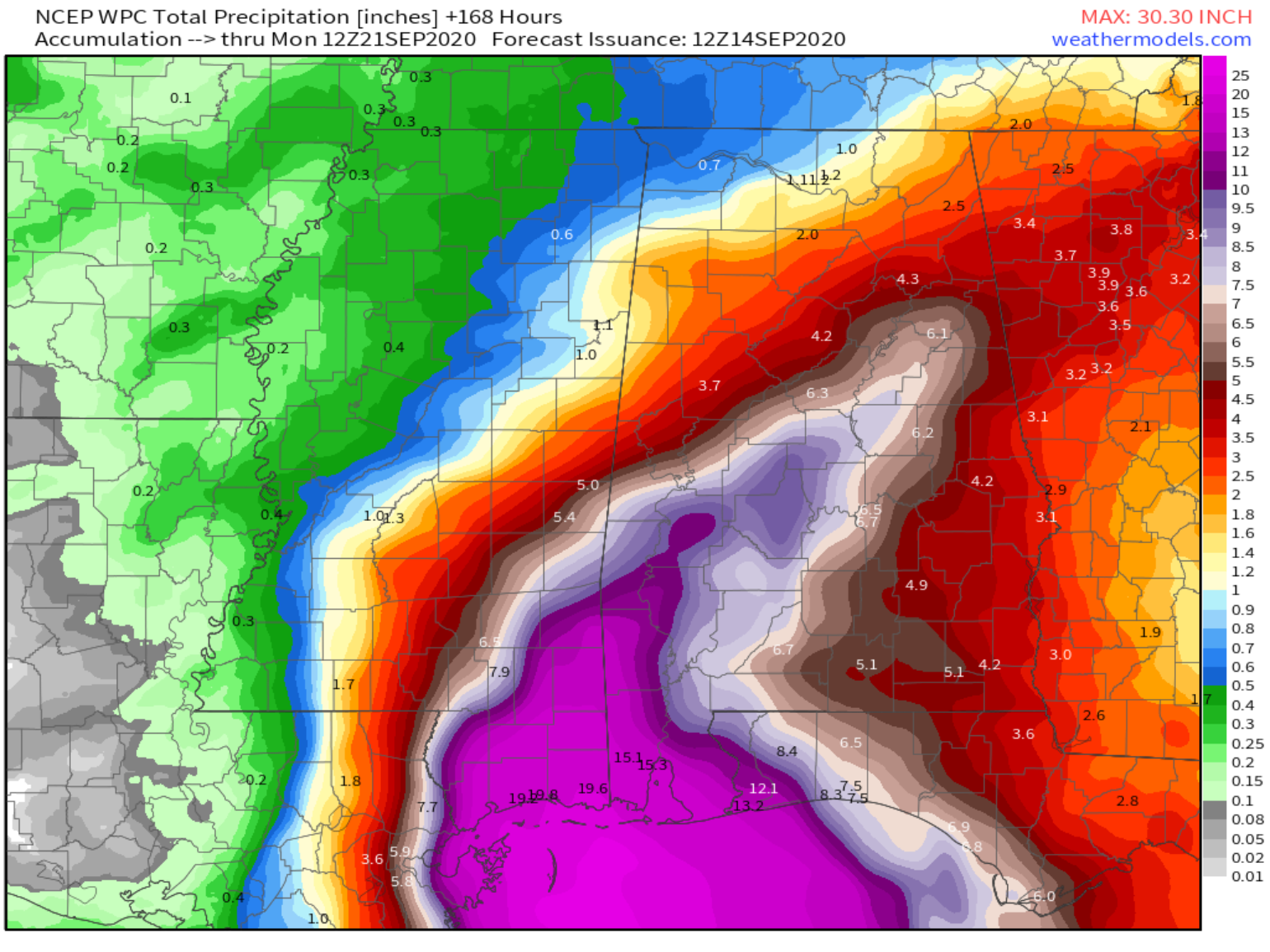
Storm surge will push into the various bays and inlets and could produce inundation of up to six feet, but it is recommended to closely follow the National Hurricane Center Storm surge forecast, which will change as the storm track changes.
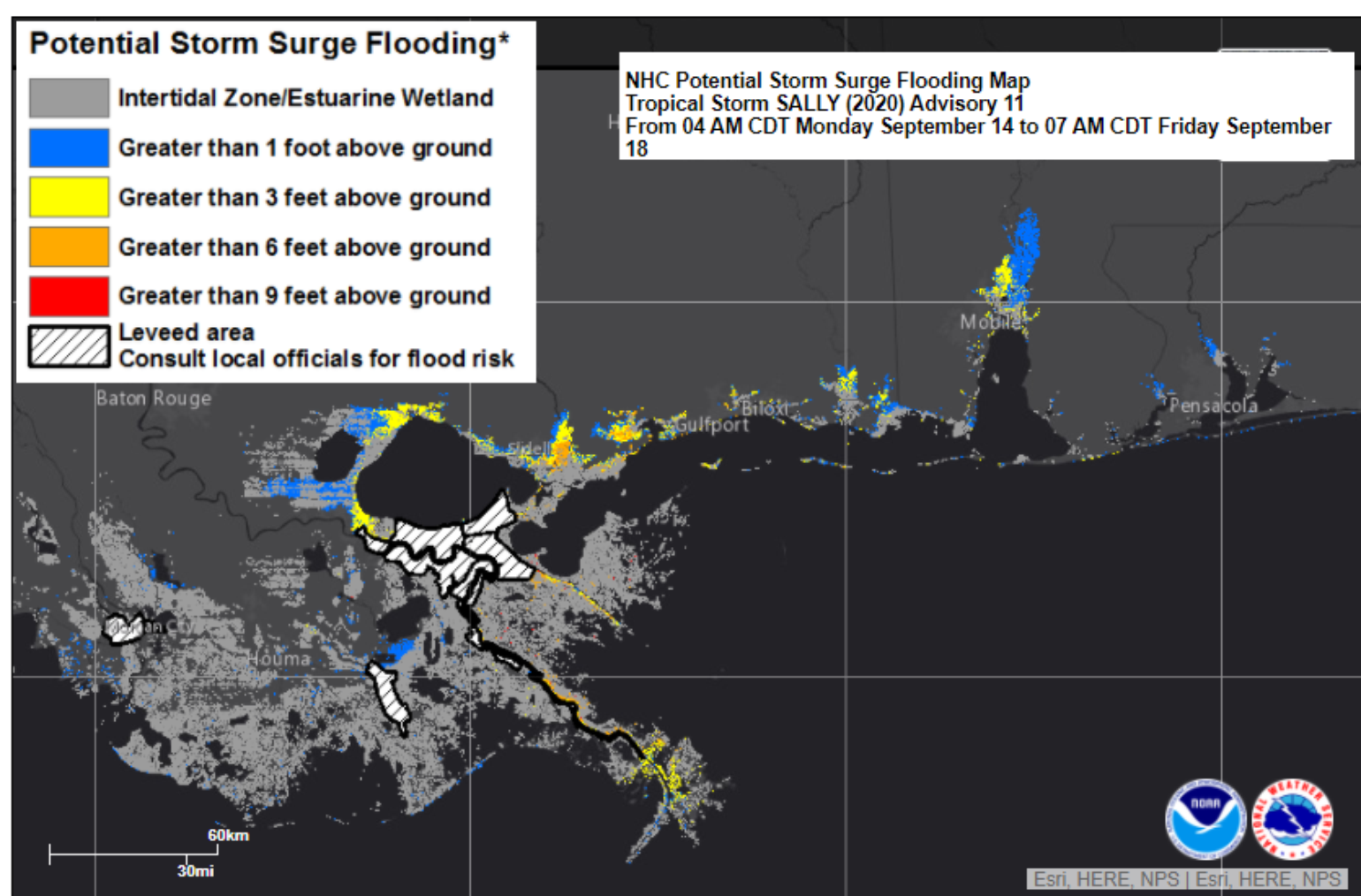
Overall water-related threats from Sally are far more serious than the storm’s winds. However, observations suggest that tropical-storm-force winds currently extend up to 125 miles from the storm’s center and will be capable of causing power outages even in areas that do not experience the storm’s core.
The biggest impacts of the highest surge, heaviest rain, and strongest winds are all focused near and just east of the center’s expected track. If the storm continues to strengthen today and ends up tracking a bit farther east, the worst of the storm would slide from near Biloxi, Mississippi closer to Mobile, Alabama. The other good news is that Alabama leads the nation in Insurance Institute for Business & Home Safety (IBHS) fortified construction, with more than 9,000 homes designated to meet the program's high standards for these homes. So between Paulette's impact on the good quality construction practices in Bermuda and the test that might be given in Alabama, these will both be yet another good story on why resiliency is the way forward in managing hurricane risk.
As Sally moves north on Wednesday, it will rapidly weaken, bring heavy rains and push inland over Mississippi and Alabama. The storm should dissipate by Thursday as it moves closer to Georga
There is no shortage of analog storms that have impacted the Gulf Coast between New Orleans, Louisiana and Mobile, Alabama. Looking at just Category 1 storms, one of the more recent storms to take a similar track is Cindy from 2005. Today Cindy might have caused around an adjusted $200 million of insurance loss. Nate in 2017 might be another good analog to Sally, which caused only $110 million of insurance loss. Overall these analogs result in a much lower insurance impact given the worst of the storm's impacts will be east of the population center of New Orleans.
Overview of the threats Sally posesto the northern Gulf Coast.
-Storm surge of 7-10 feet in southeast Louisiana coastal Mississippi
-Heavy rain of over 20" in coastal Mississippi and Alabama
-Winds of 75-90 mph in coastal Mississippi and Alabama
Dangerous surge >3 feet and flooding rain >12" will extend as far east as western Florida.
